Mapping Crashes for Safer Streets
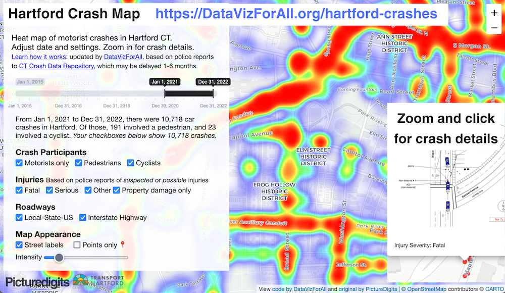
In partnership with street safety advocates and urban planners in Connecticut, Ilya Ilyankou, Keelyn McNamara, and I designed an interactive crash map to help local users identify dangerous roadways and intersections. While the Connecticut Crash Data Repository compiles police reports on motor vehicle crashes and injuries, their platform is difficult for newer users to navigate. In response, Ilya created the first Hartford Crash Map with the Transport Hartford advocacy group. Later, Keelyn and I revised the map in partnership with City of Hartford urban planners during our Data Visualization for All course at Trinity College in Spring 2023. Our updated Hartford Crash Map displays data as colored heat map clusters or individual crash points, with easy-to-use filters by time period, crash type, and injury severity, making it easier for all users to identify local patterns. We also created a West Hartford Crash Map for safety advocates and planners in that community. See our open-source code to create your own version.